Projections / Datum / Coordinate Systems
In order to represent the earth on a map two dimensional comes a multiplicity projections to the use. Each projection has it benefit. A GPS recipient usually send in the format WGS84. It is necessarily to transform the coordinate in WGS84 into the format of the digital map. Sometimes, the difference is few hunderd meters between two different formats. If the wrong format has choosen a deviation to the reall postion will be the consequence.
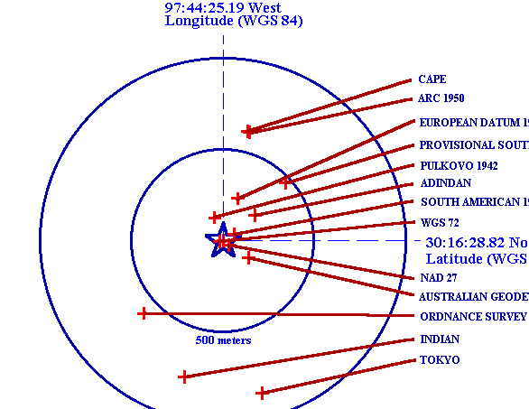
Example ( Source: http://www.colorado.edu/geography/gcraft/notes/datum/datum.html )